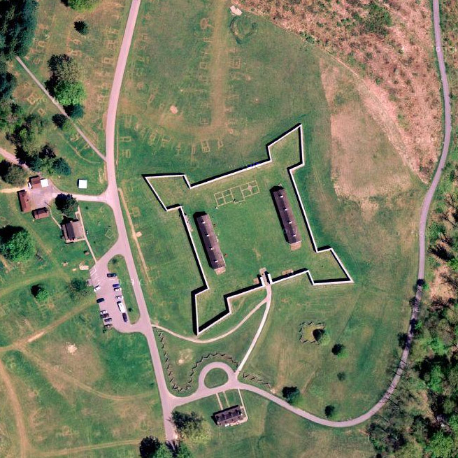
Fort Frederick as it lies. I got all excited when I found this image at Google Maps and saw, just to the north of the fort, evidence of lots of little buildings that are no longer there. Oo, thought I, the long-gone dwellings of the Civilian Conservation Corps in the 1930's? THAT excitement was cruelly dashed by Robert Study, a Ranger at Fort Frederick State Park, who responded at length to a few questions I sent by email about the fort after my visit:
On Google maps what you are seeing to the north of the fort is the damage caused to the grounds by an annual event called Market Fair. We have around 150 sutlers who sell 18th century reproductions to about 5,000 visitors over a four day period at the end of April. Those are trampled areas where people have walked and tents were set up. The CCC at Fort Frederick State Park lived in large barracks constructed to the west of the fort. The area is now covered by forest.
Additionally, perhaps you'll note the V-shaped structure a little further to the north, at the center top of this picture. Ranger Study explained that this is a model of a redan (French for 'projection' or 'salient'), constructed in relatively recent times by Boy Scouts, who were perhaps preparing for an attack by the Soviet Union's Young Pioneers at the time.
 |
 |
 |