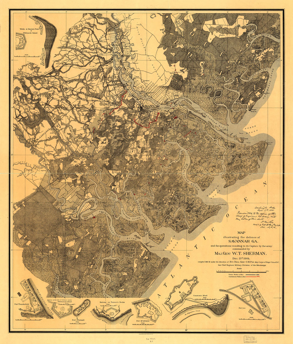
This map, of Confederate defenses arrayed around Savannah during the US Civil War (printed in the 1880's), is displayed at the fort. It was covered with protective, shiny plastic, which made it impossible to get a decent picture, but I found this copy at the Library of Congress' spectacular website. Witness the delightfully weird shapes of Georgia's depicted fortifications! Click here to see a larger version.
 |
 |
 |