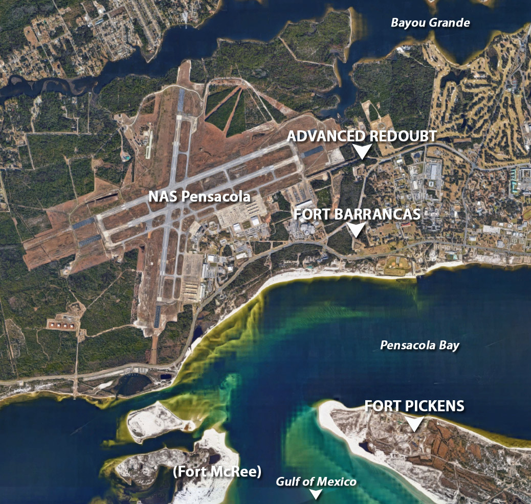
As is made clear with this map, Pensacola Bay was a singularly fortified body of water. When the United States nabbed the most excellent anchorage of Pensacola from Spain in the 1820's, it got serious about protecting it in a big hurry! This made sense, as Spain, France and Britain all had an interest in nabbing it right back if they could. Each of the forts on this map are beautiful standing representations of the starfortilogical arts, except for Fort McRee, which is a little scattering of bricks that it virtually impossible to get to, unless you are John R. Weaver II, which, sadly, I am not. |
 |
 |
 |